File:Mesopotamia geographic.png
Size of this preview: 710 × 599 pixels. Other resolutions: 284 × 240 pixels | 569 × 480 pixels | 789 × 666 pixels.
Original file (789 × 666 pixels, file size: 696 KB, MIME type: image/png)
|
|
This is a file from the Wikimedia Commons |
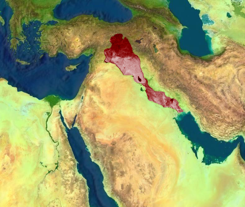
| Description | Geografic map of mesopotamia | |||
| Date | ||||
| Source | File:Middle East geographic.jpg | |||
| Author | User:Teka | |||
| Permission (Reusing this file) |
|
|||
| Other versions |
 |

File history
Click on a date/time to view the file as it appeared at that time.
| Date/Time | Thumbnail | Dimensions | User | Comment | |
|---|---|---|---|---|---|
| current | 15:42, 15 September 2010 | | 789 × 666 (696 KB) | თეკა | {{Information |Description=Geografic map of mesopotamia |Source=[http://commons.wikimedia.org/wiki/File:Middle_East_geographic.jpg] |Date=15-09-2010 |Author=User:Teka |Permission={{PD-WorldWind}} |other_versions=File:Middle East geographic.jpg }} [[C |
File usage
The following page uses this file:
Global file usage
The following other wikis use this file:
- Usage on ab.wikipedia.org
- Usage on ar.wikipedia.org
- Usage on en.wikipedia.org
- Usage on kk.wikipedia.org