File:Wavecut platform southerndown pano.jpg
Size of this preview: 800 × 401 pixels. Other resolutions: 320 × 160 pixels | 640 × 321 pixels | 1,024 × 513 pixels | 1,280 × 642 pixels | 2,393 × 1,200 pixels.
Original file (2,393 × 1,200 pixels, file size: 1.7 MB, MIME type: image/jpeg)
|
|
This is a file from the Wikimedia Commons |
Summary
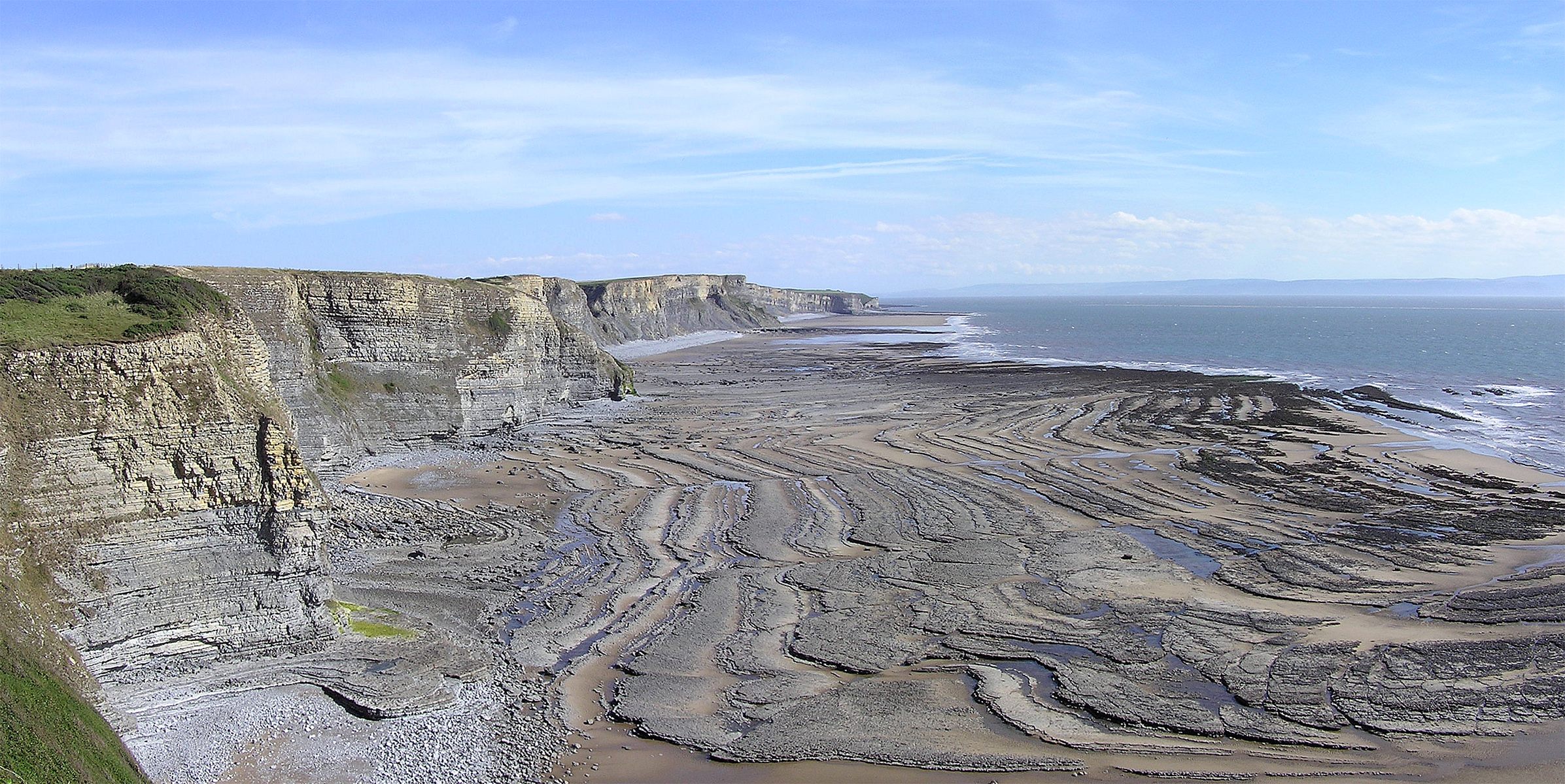
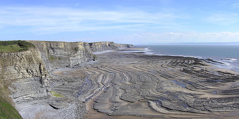
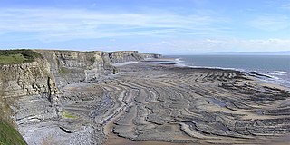
Wavecut platform, a geological feature caused by the sea's erosion of cliffs, seen at Southerndown near Bridgend, South Wales.
Image by Yummifruitbat using an Olympus C-750UZ.
| Camera location | | View this and other nearby images on: OpenStreetMap |
|---|
Licensing
This file is licensed under the Creative Commons Attribution-Share Alike 2.5 Generic license.
- You are free:
- to share – to copy, distribute and transmit the work
- to remix – to adapt the work
- Under the following conditions:
- attribution – You must give appropriate credit, provide a link to the license, and indicate if changes were made. You may do so in any reasonable manner, but not in any way that suggests the licensor endorses you or your use.
- share alike – If you remix, transform, or build upon the material, you must distribute your contributions under the same or compatible license as the original.
File history
Click on a date/time to view the file as it appeared at that time.
| Date/Time | Thumbnail | Dimensions | User | Comment | |
|---|---|---|---|---|---|
| current | 01:19, 9 May 2006 | | 2,393 × 1,200 (1.7 MB) | Yummifruitbat | Wavecut platform, a geological feature caused by the sea's erosion of cliffs, seen at Southerndown near Bridgend, South Wales. <br>Image by Yummifruitbat using an Olympus C-750UZ. |
File usage
The following page uses this file:
Global file usage
The following other wikis use this file:
- Usage on af.wikipedia.org
- Usage on ar.wikipedia.org
- Usage on ast.wikipedia.org
- Usage on bg.wikipedia.org
- Usage on ckb.wikipedia.org
- Usage on de.wikipedia.org
- Usage on en.wikipedia.org
- Usage on es.wikipedia.org
- Usage on eu.wikipedia.org
- Usage on fa.wikipedia.org
- Usage on gl.wikipedia.org
- Usage on ha.wikipedia.org
- Usage on hu.wikipedia.org
- Usage on it.wikibooks.org
- Usage on it.wikiversity.org
- Usage on kn.wikipedia.org
- Usage on kw.wikipedia.org
- Usage on pa.wikipedia.org
- Usage on pl.wikipedia.org
- Usage on pl.wiktionary.org
- Usage on pt.wikipedia.org
- Usage on ro.wikipedia.org
- Usage on sl.wikipedia.org
- Usage on tr.wikipedia.org
- Usage on uk.wikipedia.org
- Usage on vi.wikipedia.org
- Usage on www.wikidata.org
- Usage on zh.wikipedia.org