File:Red Line Map.png
No higher resolution available.
Red_Line_Map.png (774 × 570 pixels, file size: 53 KB, MIME type: image/png)
|
|
This is a file from the Wikimedia Commons |
| Description |
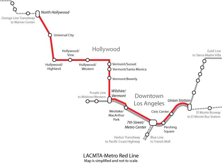
Map of the B Line in Los Angeles, California.
|
| Source | http://en.wikipedia.org/wiki/Image:Red_Line_Map.png |
| Author | Ricky Courtney |
| Permission (Reusing this file) |
This file is licensed under the Creative Commons Attribution 2.0 Generic license.
|
File history
Click on a date/time to view the file as it appeared at that time.
| Date/Time | Thumbnail | Dimensions | User | Comment | |
|---|---|---|---|---|---|
| current | 02:36, 10 June 2008 | | 774 × 570 (53 KB) | Arturoramos | {{Information |Description=Map of the Red Line in Los Angeles, California. Created 2006, by Ricky Courtney, please credit. |Source=http://en.wikipedia.org/wiki/Image:Red_Line_Map.png |Date= |Author=Ricky Courtney |Permission={{cc-by-2.0}} |other_versions= |
File usage
The following page uses this file:
Global file usage
The following other wikis use this file:
- Usage on fr.wikipedia.org
- Usage on it.wikipedia.org
- Usage on pl.wikipedia.org
- Usage on ru.wikipedia.org