File:Plan de Versailles - Gesamtplan von Delagrife 1746.jpg

Size of this preview: 800 × 528 pixels. Other resolutions: 320 × 211 pixels | 640 × 422 pixels | 1,024 × 676 pixels | 1,280 × 845 pixels | 2,560 × 1,690 pixels | 3,227 × 2,130 pixels.
Original file (3,227 × 2,130 pixels, file size: 3.71 MB, MIME type: image/jpeg)
|
|
This is a file from the Wikimedia Commons |
Summary
| Artist |
|
|||||||||||||||||||||||
| Description |
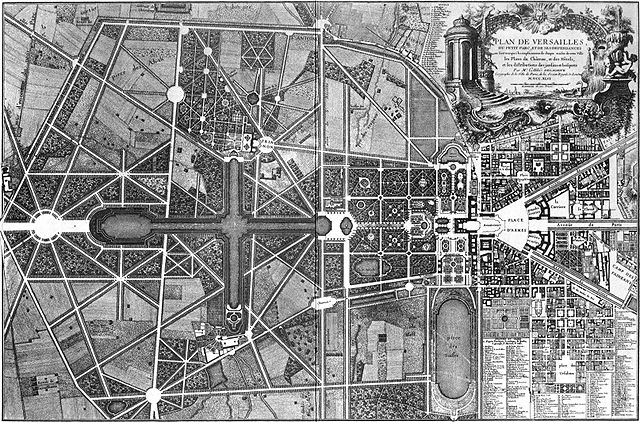
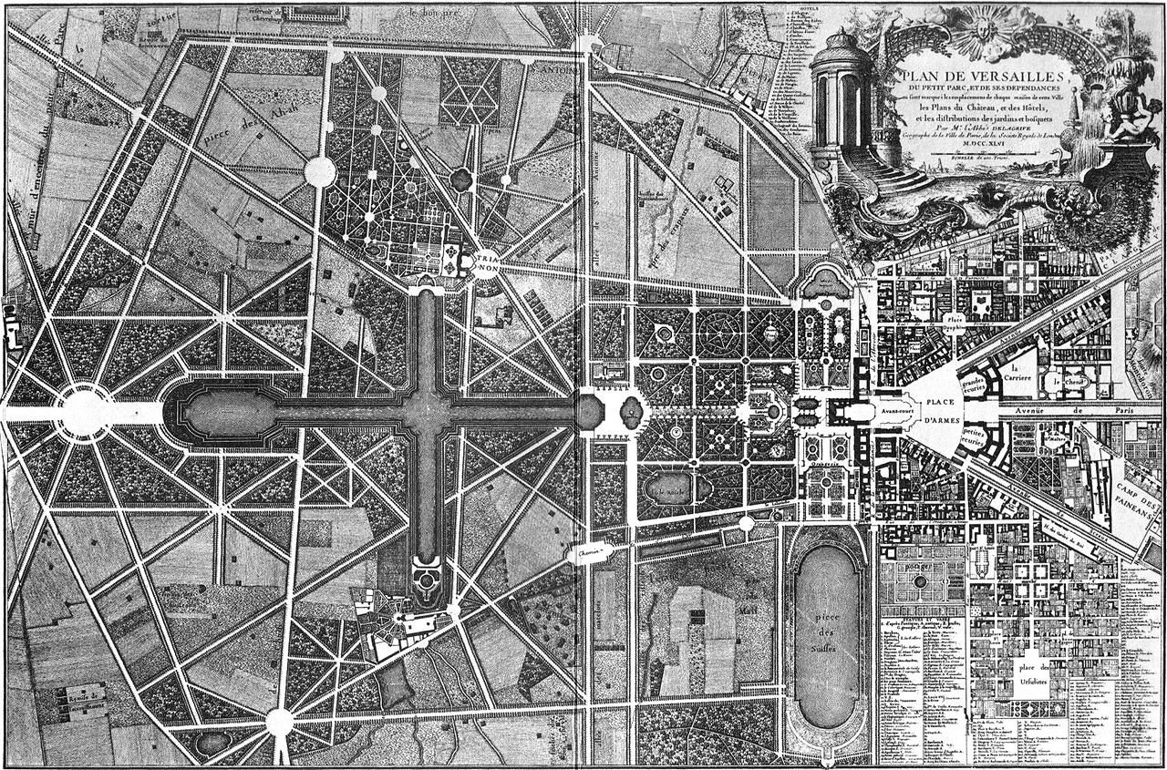
Français : "Plan de Versailles, du petit parc, et de ses dependances où sont marqués les emplacemens de chaque maison de cette ville, les plans du Château, et des hôtels, et les distributions des jardins et bosquets" par Mr l'abbé Delagrive(1689-1757) - M D CC XLVI (1746) English: Map of Versailles, by Delagrive (1689-1757), 1746. |
|||||||||||||||||||||||
| Date | 1746 | |||||||||||||||||||||||
| Notes |
|
|||||||||||||||||||||||
| Source/Photographer | Jean Delagrive | |||||||||||||||||||||||
| Other versions |
|
|||||||||||||||||||||||
,_g%C3%A9ographe_et_graveur._-_P2672_-_Mus%C3%A9e_Carnavalet.jpg)

Licensing
|
The author died in 1757, so this work is in the public domain in its country of origin and other countries and areas where the copyright term is the author's life plus 100 years or fewer. This work is in the public domain in the United States because it was published (or registered with the U.S. Copyright Office) before January 1, 1929. | |
| This file has been identified as being free of known restrictions under copyright law, including all related and neighboring rights. | |
File history
Click on a date/time to view the file as it appeared at that time.
| Date/Time | Thumbnail | Dimensions | User | Comment | |
|---|---|---|---|---|---|
| current | 19:11, 9 January 2008 | | 3,227 × 2,130 (3.71 MB) | Sitacuisses | contrast enhanced |
| 14:08, 22 April 2006 |  | 3,227 × 2,130 (2.04 MB) | Greenhorn~commonswiki | Plan de Versailles, Delagrife, 1746 |
File usage
The following page uses this file:
Global file usage
The following other wikis use this file:
- Usage on bg.wikipedia.org
- Usage on bs.wikipedia.org
- Usage on cs.wikipedia.org
- Usage on de.wikipedia.org
- Usage on el.wikipedia.org
- Usage on en.wikipedia.org
- Usage on fr.wikipedia.org
- Usage on he.wikipedia.org
- Usage on it.wikipedia.org
- Usage on lt.wikipedia.org
- Usage on nds.wikipedia.org
- Usage on pt.wikipedia.org
- Usage on sh.wikipedia.org
- Usage on sk.wikipedia.org
- Usage on sl.wikipedia.org
- Usage on sr.wikipedia.org
- Usage on www.wikidata.org