File:Night sky.jpg
Size of this preview: 800 × 533 pixels. Other resolutions: 320 × 213 pixels | 640 × 427 pixels | 1,024 × 683 pixels | 1,280 × 853 pixels | 2,560 × 1,707 pixels | 4,272 × 2,848 pixels.
Original file (4,272 × 2,848 pixels, file size: 8.01 MB, MIME type: image/jpeg)
|
|
This is a file from the Wikimedia Commons |
| Description |
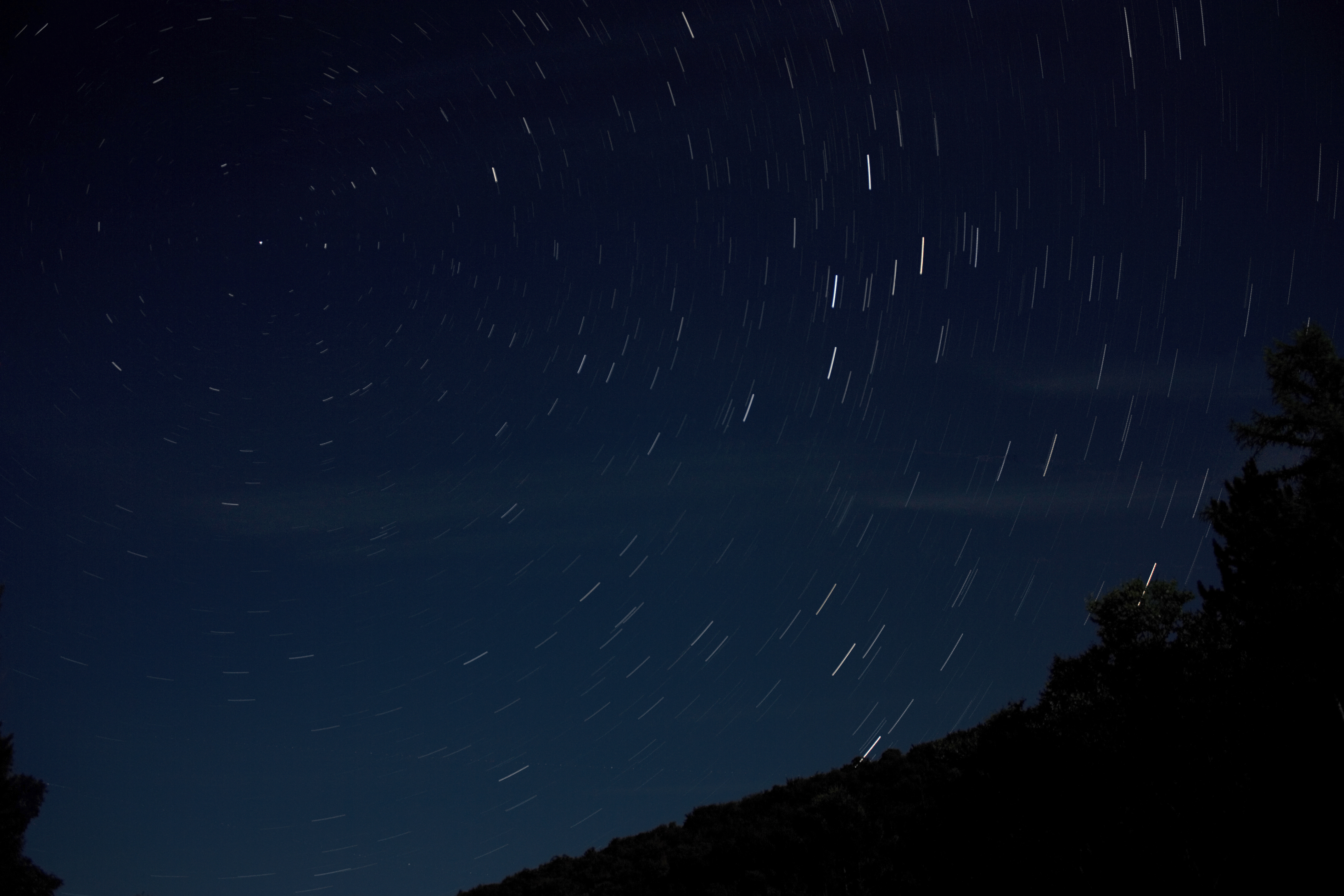
The area surrounding Coudersport is known for some of the darkest skies in the east. Erie is the closest major city, 2 hours away. There was a full moon this night or even more stars would be seen. Got 15 minutes of 30" exposures until condensation started to form. |
| Date | |
| Source | northern tier sky |
| Author | Andy from Pittsburgh, United States |
| Camera location | | View this and other nearby images on: OpenStreetMap |
|---|
Licensing
This file is licensed under the Creative Commons Attribution 2.0 Generic license.
- You are free:
- to share – to copy, distribute and transmit the work
- to remix – to adapt the work
- Under the following conditions:
- attribution – You must give appropriate credit, provide a link to the license, and indicate if changes were made. You may do so in any reasonable manner, but not in any way that suggests the licensor endorses you or your use.
| This image, originally posted to Flickr, was reviewed on November 18, 2008 by the administrator or reviewer File Upload Bot (Magnus Manske), who confirmed that it was available on Flickr under the stated license on that date. |
File history
Click on a date/time to view the file as it appeared at that time.
| Date/Time | Thumbnail | Dimensions | User | Comment | |
|---|---|---|---|---|---|
| current | 16:47, 18 November 2008 | | 4,272 × 2,848 (8.01 MB) | File Upload Bot (Magnus Manske) | {{Information |Description= The area surrounding Coudersport is known for some of the darkest skies in the east. Erie is the closest major city, 2 hours away. There was a [http://www.flickr.com/photos/truello/2767380428/ full moon] this night or even mo |
File usage
The following 3 pages use this file:
Global file usage
The following other wikis use this file:
- Usage on fr.wikipedia.org
- Usage on th.wikibooks.org