File:Nepal relief location map.jpg
Size of this preview: 800 × 476 pixels. Other resolutions: 320 × 190 pixels | 640 × 381 pixels | 1,200 × 714 pixels.
Original file (1,200 × 714 pixels, file size: 635 KB, MIME type: image/jpeg)
|
|
This is a file from the Wikimedia Commons |
Summary
| Description |
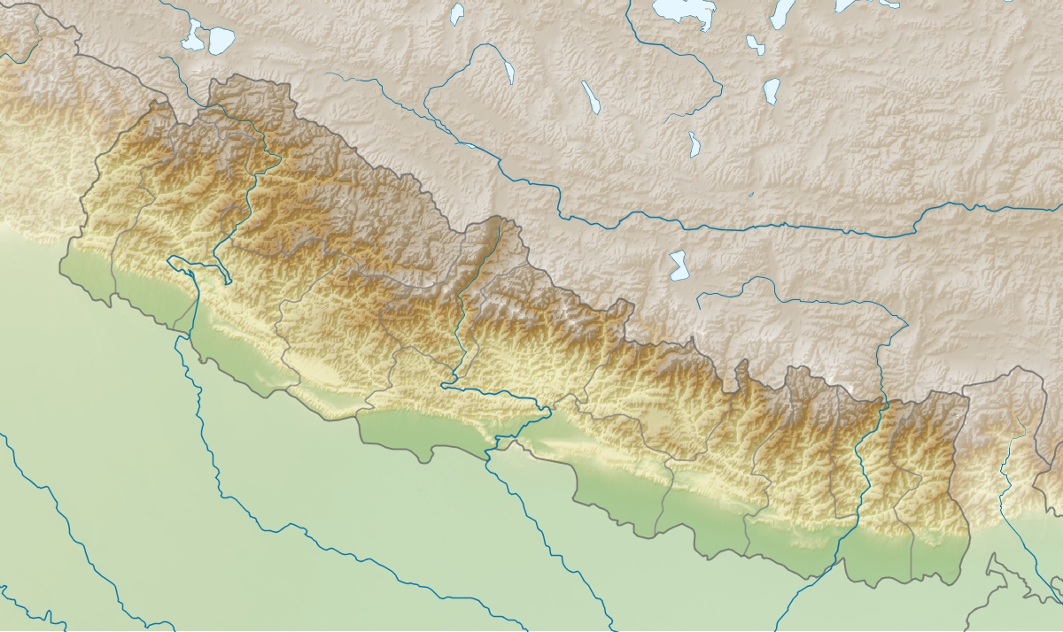
English: Location map of Nepal including the 14 administrative zones (outdated since 2015).
Equirectangular projection. Stretched by 113.0%. Geographic limits of the map: * N: 27.633 N * S: 26.0° N * W: 79.5° E * E: 84.109° EMade with Natural Earth. Free vector and raster map data @ naturalearthdata.com. |
| Date | |
| Source | Own work |
| Author | Uwe Dedering |
| Other versions |
|

Licensing
I, the copyright holder of this work, hereby publish it under the following licenses:
This file is licensed under the Creative Commons Attribution-Share Alike 3.0 Unported license.
- You are free:
- to share – to copy, distribute and transmit the work
- to remix – to adapt the work
- Under the following conditions:
- attribution – You must give appropriate credit, provide a link to the license, and indicate if changes were made. You may do so in any reasonable manner, but not in any way that suggests the licensor endorses you or your use.
- share alike – If you remix, transform, or build upon the material, you must distribute your contributions under the same or compatible license as the original.

|
Permission is granted to copy, distribute and/or modify this document under the terms of the GNU Free Documentation License, Version 1.2 or any later version published by the Free Software Foundation; with no Invariant Sections, no Front-Cover Texts, and no Back-Cover Texts. A copy of the license is included in the section entitled GNU Free Documentation License. |
You may select the license of your choice.
File history
Click on a date/time to view the file as it appeared at that time.
| Date/Time | Thumbnail | Dimensions | User | Comment | |
|---|---|---|---|---|---|
| current | 09:57, 24 April 2010 | | 1,200 × 714 (635 KB) | Uwe Dedering | {{Information |Description={{en|1=Location map of Nepal. Equirectangular projection. Strechted by 113.0%. Geographic limits of the map: * N: 31.0° N * S: 26.0° N * W: 79.5° E * E: 89.0° E Made with Natural Earth. Free vector and raster map data |
File usage
The following 3 pages use this file:
Global file usage
The following other wikis use this file:
- Usage on am.wikipedia.org
- Usage on ar.wikipedia.org
- Usage on ast.wikipedia.org
- Usage on as.wikipedia.org
- Usage on azb.wikipedia.org
- Usage on ba.wikipedia.org
- Usage on be-tarask.wikipedia.org
- Usage on bg.wikipedia.org
- Usage on bh.wikipedia.org
- Usage on bn.wikipedia.org
- Usage on bs.wikipedia.org
- Usage on ca.wikipedia.org
- Usage on ceb.wikipedia.org
- Usage on ce.wikipedia.org
- Usage on ckb.wikipedia.org
- Usage on de.wikipedia.org
View more global usage of this file.