File:Lonely S (18976521999).jpg
Size of this preview: 800 × 530 pixels. Other resolutions: 320 × 212 pixels | 640 × 424 pixels | 1,024 × 678 pixels | 1,280 × 848 pixels | 1,631 × 1,080 pixels.
Original file (1,631 × 1,080 pixels, file size: 2.15 MB, MIME type: image/jpeg)
|
|
This is a file from the Wikimedia Commons |
.jpg)
Summary
| Description |
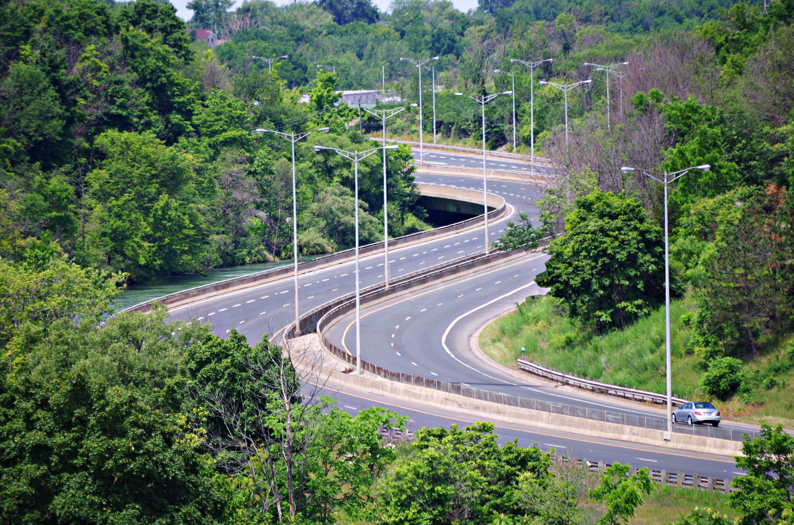
There are few shapes more appealing than a S shaped curve. In particular, on roads, the S curve strongly suggests travel, adventure and exploration. It also has a calm and pleasant appearance. A view of an S bend always builds a desire for a road trip. Highway 406 slithers across the Twelve Mile Creek in this award winning S bend bridge in St. Catharines, Ontario. |
| Date | |
| Source | Lonely S |
| Author | Michael Pardo from Niagara, Canada |
| Camera location | | View this and other nearby images on: OpenStreetMap |
|---|
.jpg¶ms=043.152389_N_-079.247281_E_globe:Earth_type:camera_source:Flickr_&language=en)
Licensing
| This file is made available under the Creative Commons CC0 1.0 Universal Public Domain Dedication. | |
| The person who associated a work with this deed has dedicated the work to the public domain by waiving all of their rights to the work worldwide under copyright law, including all related and neighboring rights, to the extent allowed by law. You can copy, modify, distribute and perform the work, even for commercial purposes, all without asking permission.
|
| This image was originally posted to Flickr by mpardo.photo at https://flickr.com/photos/130551911@N05/18976521999. It was reviewed on 28 March 2016 by FlickreviewR and was confirmed to be licensed under the terms of the cc-zero. |
File history
Click on a date/time to view the file as it appeared at that time.
| Date/Time | Thumbnail | Dimensions | User | Comment | |
|---|---|---|---|---|---|
| current | 22:24, 28 March 2016 | | 1,631 × 1,080 (2.15 MB) | Mindmatrix | Transferred from Flickr via Flickr2Commons |
File usage
The following page uses this file:
Global file usage
The following other wikis use this file:
- Usage on bn.wikibooks.org
- Usage on en.wikipedia.org
- Usage on fa.wikibooks.org
- Usage on fr.wikibooks.org
- Usage on shn.wikibooks.org
.jpg)