File:Battle of Hampton Roads Map.png
Size of this preview: 603 × 600 pixels. Other resolutions: 241 × 240 pixels | 483 × 480 pixels | 939 × 934 pixels.
Original file (939 × 934 pixels, file size: 397 KB, MIME type: image/png)
|
|
This is a file from the Wikimedia Commons |
Summary
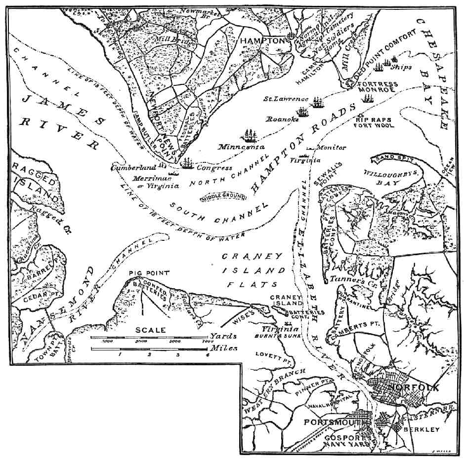
| Description | "Map of Hampton Roads and Vicinity." The First Fight of Iron-clads. |
| Date | |
| Source | The Century Magazine, Vol. XXIX, March 1885. |
| Author | John Taylor Wood. |
| Permission (Reusing this file) |
public domain |
Source.
A higher-resolution, more detailed, color map of the Battle of Hampton Roads is available at the Library of Congress website.
Taken via Wikipedia-En, originally uploaded by en:User:Brian0918
Licensing
This work is in the public domain in the United States because it was published (or registered with the U.S. Copyright Office) before January 1, 1929.
Public domain works must be out of copyright in both the United States and in the source country of the work in order to be hosted on the Commons. If the work is not a U.S. work, the file must have an additional copyright tag indicating the copyright status in the source country.
Note: This tag should not be used for sound recordings. |
File history
Click on a date/time to view the file as it appeared at that time.
| Date/Time | Thumbnail | Dimensions | User | Comment | |
|---|---|---|---|---|---|
| current | 19:09, 3 October 2005 | | 939 × 934 (397 KB) | Pibwl |
File usage
There are no pages that use this file.
Global file usage
The following other wikis use this file:
- Usage on da.wikipedia.org
- Usage on de.wikipedia.org
- Usage on en.wikipedia.org
- Usage on fr.wikipedia.org
- Usage on he.wikipedia.org
- Usage on it.wikipedia.org
- Usage on ja.wikipedia.org
- Usage on nl.wikipedia.org
- Usage on pl.wikipedia.org
- Usage on ru.wikipedia.org
- Usage on sr.wikipedia.org
- Usage on sv.wikipedia.org
- Usage on uk.wikipedia.org