File:Anthoxanthum hirtum nymap.svg

Size of this PNG preview of this SVG file: 640 × 500 pixels. Other resolutions: 307 × 240 pixels | 983 × 768 pixels | 1,280 × 1,000 pixels | 2,560 × 2,000 pixels.
Original file (SVG file, nominally 640 × 500 pixels, file size: 224 KB)
|
|
This is a file from the Wikimedia Commons |
Summary
| Description |
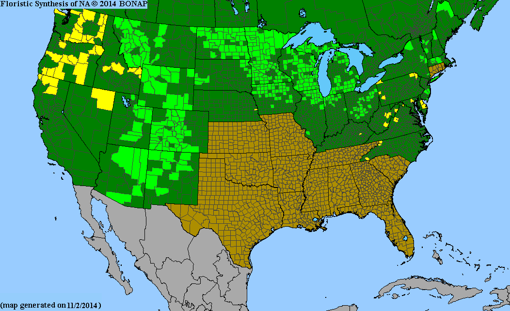
English: New York State county-level flora distribution map. Counties indicated are based primarily on data from Troy Weldy, David Werier, and Andrew Nelson. 2016. New York Flora Atlas. New York Flora Association, Albany, New York.
For this particular map (Anthoxanthum hirtum) the data is from http://bonap.net/MapGallery/County/Anthoxanthum%20hirtum.png because it was not available from NYFA |
| Date | |
| Source | Own work |
| Author | Nonenmac |
Licensing
I, the copyright holder of this work, hereby publish it under the following license:
This file is licensed under the Creative Commons Attribution-Share Alike 4.0 International license.
- You are free:
- to share – to copy, distribute and transmit the work
- to remix – to adapt the work
- Under the following conditions:
- attribution – You must give appropriate credit, provide a link to the license, and indicate if changes were made. You may do so in any reasonable manner, but not in any way that suggests the licensor endorses you or your use.
- share alike – If you remix, transform, or build upon the material, you must distribute your contributions under the same or compatible license as the original.
File history
Click on a date/time to view the file as it appeared at that time.
| Date/Time | Thumbnail | Dimensions | User | Comment | |
|---|---|---|---|---|---|
| current | 14:05, 10 November 2016 | | 640 × 500 (224 KB) | Nonenmac | User created page with UploadWizard |
File usage
The following page uses this file: