File:Pilsbury Castle Hills (5 of 5) - geograph.org.uk - 1714290.jpg
Pilsbury_Castle_Hills_(5_of_5)_-_geograph.org.uk_-_1714290.jpg (640 × 368 pixels, file size: 88 KB, MIME type: image/jpeg)
|
|
This is a file from the Wikimedia Commons |
_-_geograph.org.uk_-_1714290.jpg)
Summary
| Description |
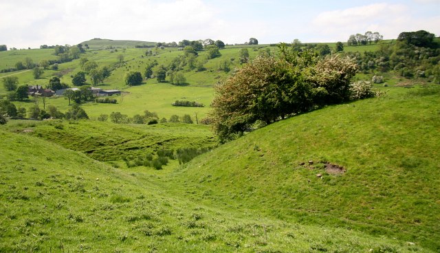
English: Pilsbury Castle Hills (5 of 5) 1714270: Previous image - - - First image : 1714232
Taken from inside the site of the castle this south-westerly facing photograph shows the remains of earthworks at Pilsbury motte-and-bailey castle. The mound on the right is the remains of the motte. The hill in the distance is Sheen Hill (SK111626). Also seen is Broadmeadow Hall and attendant farm buildings (SK118636). See this NGFL web site for information about, and a worksheet on, motte-and-bailey castles: http://www.ngfl-cymru.org.uk/vtc/20050408/newhistor/keystage3/castlesde/castles/themottea/ See also The British History Site: http://www.etrusia.co.uk/mottes.php |
| Date | |
| Source | From geograph.org.uk |
| Author | Alan Walker |
| Attribution (required by the license) | Alan Walker / Pilsbury Castle Hills (5 of 5) / |
_-_geograph.org.uk_-_1714270.jpg)
_-_geograph.org.uk_-_1714232.jpg)
| Camera location | | View this and other nearby images on: OpenStreetMap |
|---|
_-_geograph.org.uk_-_1714290.jpg¶ms=053.171420_N_-001.830500_E_globe:Earth_type:camera_source:geograph-osgb36(SK11426382)_heading:202.00&language=en)
| Object location | | View this and other nearby images on: OpenStreetMap |
|---|
_-_geograph.org.uk_-_1714290.jpg¶ms=053.171060_N_-001.830700_E_globe:Earth_class:object_type:object_source:geograph-osgb36(SK11416378)_heading:202.00&language=en)
Licensing

|
This image was taken from the Geograph project collection. See this photograph's page on the Geograph website for the photographer's contact details. The copyright on this image is owned by Alan Walker and is licensed for reuse under the Creative Commons Attribution-ShareAlike 2.0 license.
|
- You are free:
- to share – to copy, distribute and transmit the work
- to remix – to adapt the work
- Under the following conditions:
- attribution – You must give appropriate credit, provide a link to the license, and indicate if changes were made. You may do so in any reasonable manner, but not in any way that suggests the licensor endorses you or your use.
- share alike – If you remix, transform, or build upon the material, you must distribute your contributions under the same or compatible license as the original.
File history
Click on a date/time to view the file as it appeared at that time.
| Date/Time | Thumbnail | Dimensions | User | Comment | |
|---|---|---|---|---|---|
| current | 09:01, 5 March 2011 | | 640 × 368 (88 KB) | GeographBot | == {{int:filedesc}} == {{Information |description={{en|1=Pilsbury Castle Hills (5 of 5) http://www.geograph.org.uk/photo/1714270 : Previous image - - - First image : http://www.geograph.org.uk/photo/1714232 Taken from inside the site of the castle this |
File usage
The following 2 pages use this file:
Global file usage
The following other wikis use this file:
- Usage on ceb.wikipedia.org
- Usage on de.wikipedia.org
- Usage on en.wikipedia.org
- Usage on www.wikidata.org
_-_geograph.org.uk_-_1714290.jpg)