File:No sailing today - geograph.org.uk - 838404.jpg
Size of this preview: 450 × 600 pixels. Other resolutions: 180 × 240 pixels | 480 × 640 pixels.
Original file (480 × 640 pixels, file size: 180 KB, MIME type: image/jpeg)
|
|
This is a file from the Wikimedia Commons |
Summary
| Description |
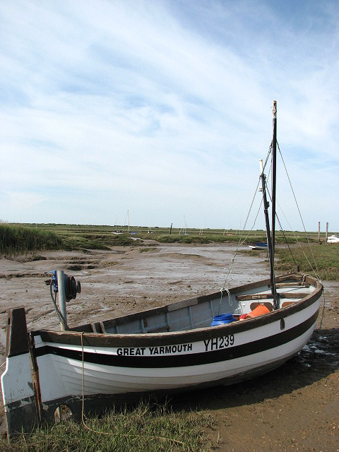
English: No sailing today The creeks are dry, the water gone out with the tide. The wet mud is glistening in the late afternoon sunshine.
Many local families still make their living by fishing from Brancaster Staithe, which is famous for its first class shellfish. The harbour is also home to Brancaster Sailing Club, and sailing dinghies can be seen stored in and around the harbour. According to most books, Admiral Horatio Nelson learnt to sail at Brancaster but since in the mid to late 18th century there was no such thing as sailing for pleasure, it is more likely that he visited Brancaster Staithe from his home in nearby Burnham Thorpe, and persuaded local fishermen to take him out in their sailing boats. |
| Date | |
| Source | From geograph.org.uk |
| Author | Evelyn Simak |
| Attribution (required by the license) | Evelyn Simak / No sailing today / |
| Camera location | | View this and other nearby images on: OpenStreetMap |
|---|
_heading:45.00&language=en)
| Object location | | View this and other nearby images on: OpenStreetMap |
|---|
_heading:45.00&language=en)
Licensing

|
This image was taken from the Geograph project collection. See this photograph's page on the Geograph website for the photographer's contact details. The copyright on this image is owned by Evelyn Simak and is licensed for reuse under the Creative Commons Attribution-ShareAlike 2.0 license.
|
This file is licensed under the Creative Commons Attribution-Share Alike 2.0 Generic license.
Attribution: Evelyn Simak
- You are free:
- to share – to copy, distribute and transmit the work
- to remix – to adapt the work
- Under the following conditions:
- attribution – You must give appropriate credit, provide a link to the license, and indicate if changes were made. You may do so in any reasonable manner, but not in any way that suggests the licensor endorses you or your use.
- share alike – If you remix, transform, or build upon the material, you must distribute your contributions under the same or compatible license as the original.
File history
Click on a date/time to view the file as it appeared at that time.
| Date/Time | Thumbnail | Dimensions | User | Comment | |
|---|---|---|---|---|---|
| current | 20:01, 20 February 2011 | | 480 × 640 (180 KB) | GeographBot | == {{int:filedesc}} == {{Information |description={{en|1=No sailing today The creeks are dry, the water gone out with the tide. The wet mud is glistening in the late afternoon sunshine. Many local families still make their living by fishing from Branca |
File usage
The following 2 pages use this file: