File:Mid-ocean ridge system.gif

Size of this preview: 800 × 487 pixels. Other resolutions: 320 × 195 pixels | 640 × 389 pixels | 1,152 × 701 pixels.
Original file (1,152 × 701 pixels, file size: 500 KB, MIME type: image/gif)
|
|
This is a file from the Wikimedia Commons |
Summary
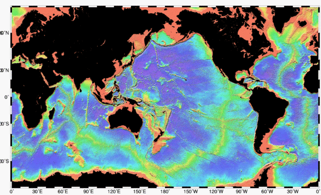
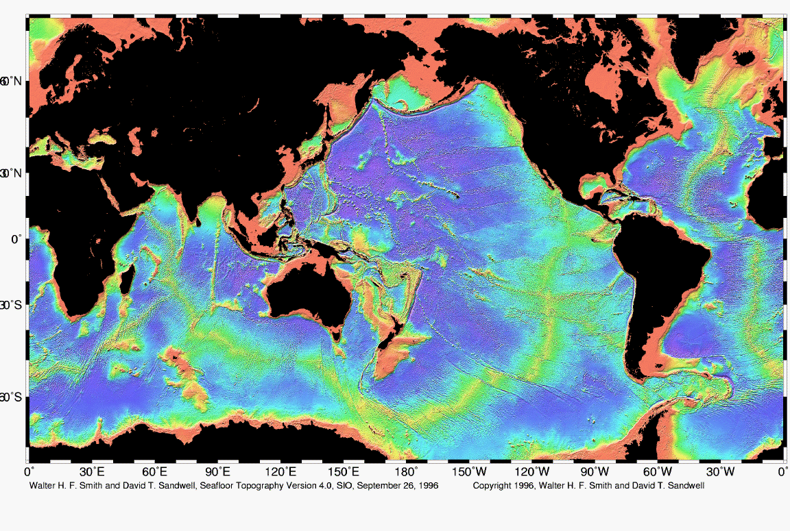
| Description | Map of the mid-ocean ridge system (yellow-green) in the Earth’s oceans. |
| Date | |
| Source | http://www.ngdc.noaa.gov/mgg/image/global_topo_large.gif |
| Author | National Oceanic and Atmospheric Administration |
Licensing
This image is in the public domain because it contains materials that originally came from the U.S. National Oceanic and Atmospheric Administration, taken or made as part of an employee's official duties.
|
File history
Click on a date/time to view the file as it appeared at that time.
| Date/Time | Thumbnail | Dimensions | User | Comment | |
|---|---|---|---|---|---|
| current | 02:48, 1 May 2010 | | 1,152 × 701 (500 KB) | Adrignola | {{Information |Description=Map of the mid-ocean ridge system (yellow-green) in the Earth’s oceans. |Source=http://www.ngdc.noaa.gov/mgg/image/global_topo_large.gif |Date=1996-09-26 |Author=w:National Oceanic and Atmospheric Administration |Permissi |
File usage
The following page uses this file:
Global file usage
The following other wikis use this file:
- Usage on ban.wikipedia.org
- Usage on en.wikipedia.org
- Usage on en.wiktionary.org
- Usage on es.wikibooks.org
- Usage on hy.wikipedia.org
- Usage on id.wikipedia.org
- Usage on ko.wikipedia.org
- Usage on ru.wikipedia.org
- Usage on tw.wikipedia.org