File:Kentmere hall.jpg
No higher resolution available.
Kentmere_hall.jpg (640 × 468 pixels, file size: 107 KB, MIME type: image/jpeg)
|
|
This is a file from the Wikimedia Commons |
Summary
| Description |
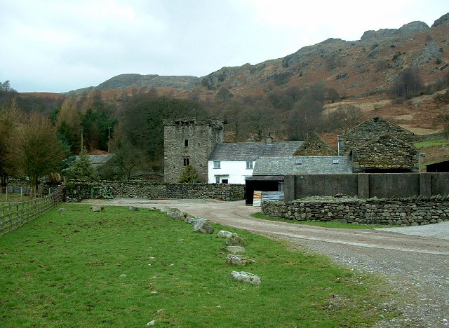
English: Kentmere Hall. A 14th century tunnel-vaulted pele tower with five-foot thick walls. The turrets, one of the original windows and the spiral staircase remain. The tower was extended now a farmhouse. |
| Date | |
| Source | From geograph.org.uk |
| Author | Nigel Homer |
| Permission (Reusing this file) |
Creative Commons Attribution Share-alike license 2.0 |
| Object location | | View this and other nearby images on: OpenStreetMap |
|---|
_region:GB-GBN_&language=en)
Licensing

|
This image was taken from the Geograph project collection. See this photograph's page on the Geograph website for the photographer's contact details. The copyright on this image is owned by Nigel Homer and is licensed for reuse under the Creative Commons Attribution-ShareAlike 2.0 license.
|
This file is licensed under the Creative Commons Attribution-Share Alike 2.0 Generic license.
Attribution: Nigel Homer
- You are free:
- to share – to copy, distribute and transmit the work
- to remix – to adapt the work
- Under the following conditions:
- attribution – You must give appropriate credit, provide a link to the license, and indicate if changes were made. You may do so in any reasonable manner, but not in any way that suggests the licensor endorses you or your use.
- share alike – If you remix, transform, or build upon the material, you must distribute your contributions under the same or compatible license as the original.
File history
Click on a date/time to view the file as it appeared at that time.
| Date/Time | Thumbnail | Dimensions | User | Comment | |
|---|---|---|---|---|---|
| current | 19:08, 18 March 2006 | | 640 × 468 (107 KB) | Amatire | {{geograph|118791|Nigel Homer}} Kentmere Hall. A 14th century tunnel-vaulted pele tower with five-foot thick walls. The turrets, one of the original windows and the spiral staircase remain. The tower was extended now a farmhouse. Taken on Monday, 16 Feb |
File usage
The following 2 pages use this file:
Global file usage
The following other wikis use this file:
- Usage on da.wikipedia.org
- Usage on en.wikipedia.org
- Usage on pt.wikipedia.org
- Usage on ru.wikipedia.org
- Usage on www.wikidata.org